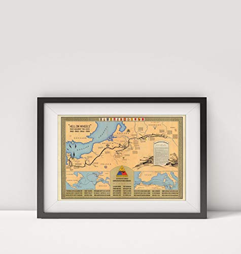
1945 Map of |Hell on Wheels : war Against The Axis, 1942-1943-1944-1945|Title: Hell on Wheels : wa
Brand: New York Map Company LLC
Share
- Map Size: 16 inches x 2 feet (40.64cm x 60.96cm) | Ready to frame in standard size frame (16x24) |Frame not included|Giclée print produced on Fine Art Paper (Weight: 235 g/m2, Thickness: 10 mil, ISO brightness: 95%) that maintains vivid colors and faithfulness to the original map | Archival Quality and guaranteed not to fade for 200+ years.
- 1945 Map of |Hell on wheels : war against the Axis, 1942-1943-1944-1945|Title: "Hell on wheels" : war against the Axis, 1942-1943-1944-1945. M.E.B. G-2 Section, 2d A.D. (insets) (Route from United States to Europe and Mediterranean Sea. Scale ca. 1:48,000, 000). (with) (Routes in Mediterranean Region. Scale ca. 1:7,800,000).
- Separate Map: "Hell on wheels" : war against the Axis, 1942-1943-1944-1945. M.E.B. G-2 Section, 2d A.D. (insets) (Route from United States to Europe and Mediterranean Sea. Scale ca. 1:48,000, 000). (with) (Routes in Mediterranean Region. Scale ca. 1:7,800,000). | "Hell on wheels" : war against the Axis, 1942-1943-1944-1945. M.E.B. G-2 Section, 2d A.D. (insets) (Route from United States to Europe and Mediterranean Sea. Scale ca. 1:48,000, 000). (with) (Routes in Mediterranean
- Shows route of 2nd Armored Division from Littry, France, to Gutergluck, Germany, with historical notes for selected locations. Includes brief history of the 2nd Armored Division. Border text includes place names, military insignia, and names of m
- Outline color. Text/Index Map pages printed in blue ink. Relief shown by hachures. Editions of this atlas extended through the years of World War II. This edition is the last edition of the Stieler atlas. It is very rare and known only in a few copies. It was printed during the final months of World War II, probably in April or May of 1945.
Featured on...
- TV Shows
- Hell on Wheels
